Isochrones and Transport Accessibility
Isochrones represent areas reachable from a starting point within a given time limit along a transport network. This functionality enables analysis of transport accessibility using pedestrian, automobile, public transport graphs, or their combination.
The library provides several methods for generating isochrones depending on the required level of detail and visualization.
Baseline Isochrones
Show a single area reachable within a specified time.
- objectnat.get_accessibility_isochrones(isochrone_type, points, weight_value, weight_type, nx_graph, **kwargs)[source]
Calculate accessibility isochrones from input points based on the provided city graph.
- Supports two types of isochrones:
‘radius’: Circular buffer-based isochrones
‘ways’: Road network-based isochrones
- Parameters:
isochrone_type (
Literal['radius','ways']) –Type of isochrone to calculate:
”radius”: Creates circular buffers around reachable nodes
”ways”: Creates polygons based on reachable road network
points (
geopandas.GeoDataFrame) – GeoDataFrame containing source points for isochrone calculation.weight_value (
float) – Maximum travel time (minutes) or distance (meters) threshold.weight_type (
Literal['time_min','length_meter']) –Type of weight calculation:
”time_min”: Time-based accessibility in minutes
”length_meter”: Distance-based accessibility in meters
nx_graph (
networkx.Graph) – NetworkX graph representing the transportation network. Must contain CRS and speed attributes for time calculations.**kwargs (
Any) –Additional parameters:
buffer_factor: Size multiplier for buffers (default: 0.7)
road_buffer_size: Buffer size for road edges in meters (default: 5)
- Returns:
Tuple containing:
isochrones: GeoDataFrame with calculated isochrone polygons
pt_stops: Public transport stops within isochrones (if available)
pt_routes: Public transport routes within isochrones (if available)
- Return type:
tuple[gpd.GeoDataFrame, gpd.GeoDataFrame | None, gpd.GeoDataFrame | None]
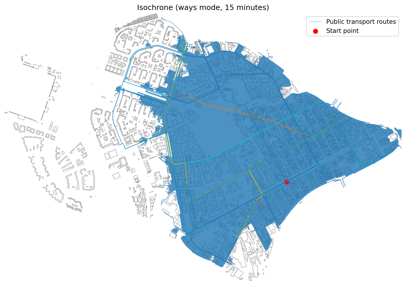
Isochrone for road network within 15 minutes.
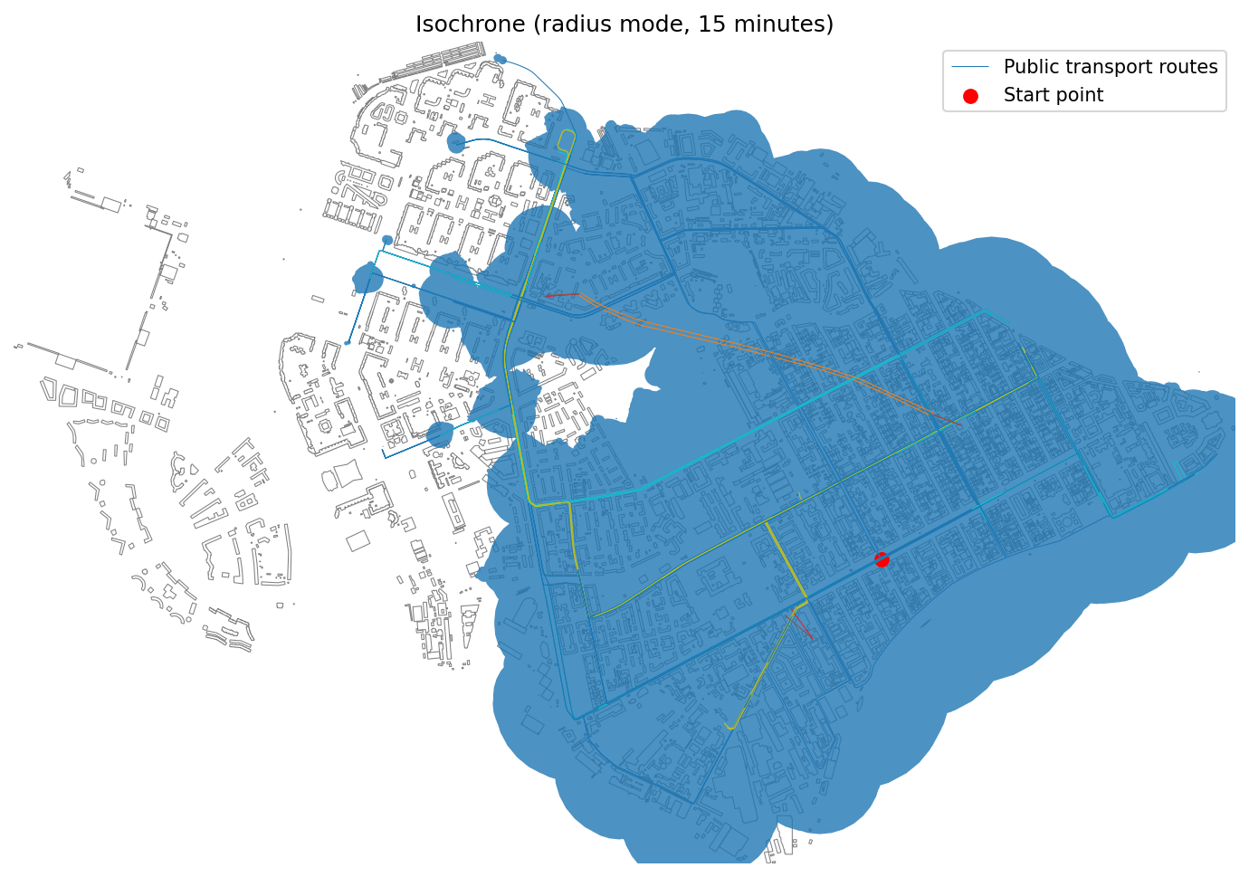
Isochrone using radius-based method (15 min).
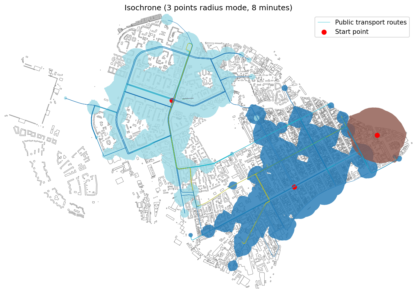
Isochrones for three start points (8 min).
Stepped Isochrones
Show accessibility ranges divided into time intervals (e.g., 5, 10, 15 minutes).
- objectnat.get_accessibility_isochrone_stepped(isochrone_type, point, weight_value, weight_type, nx_graph, step=None, **kwargs)[source]
Calculate stepped accessibility isochrones for a single point with specified intervals.
- Parameters:
isochrone_type (
Literal['radius','ways','separate']) –Visualization method for stepped isochrones:
"radius": Voronoi-based in circular buffers"ways": Voronoi-based in road network polygons"separate": Circular buffers for each step
point (
geopandas.GeoDataFrame) – Single source point for isochrone calculation (uses first geometry if multiple provided).weight_value (
float) – Maximum travel time (minutes) or distance (meters) threshold.weight_type (
Literal['time_min','length_meter']) –Type of weight calculation:
”time_min”: Time-based in minutes
”length_meter”: Distance-based in meters
nx_graph (
networkx.Graph) – NetworkX graph representing the transportation network.step (
float, optional) –Interval between isochrone steps. Defaults to:
100 meters for distance-based
1 minute for time-based
**kwargs (
Any) –Additional parameters:
buffer_factor: Size multiplier for buffers (default: 0.7)
road_buffer_size: Buffer size for road edges in meters (default: 5)
- Returns:
Tuple containing:
stepped_isochrones: GeoDataFrame with stepped polygons and distance/time attributes
pt_stops: Public transport stops within isochrones (if available)
pt_routes: Public transport routes within isochrones (if available)
- Return type:
tuple[gpd.GeoDataFrame, gpd.GeoDataFrame | None, gpd.GeoDataFrame | None]
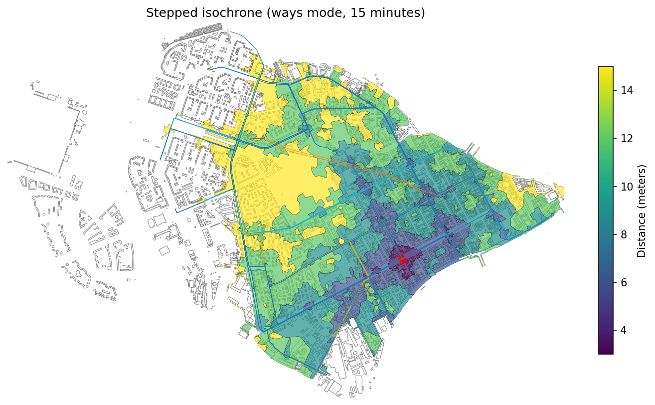
Stepped isochrones for road network (5–15 min).
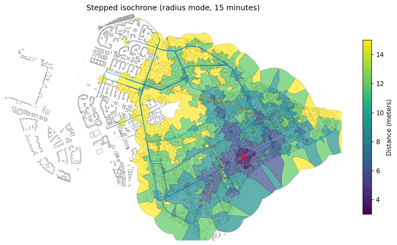
Stepped radius-based isochrones (5–15 min).
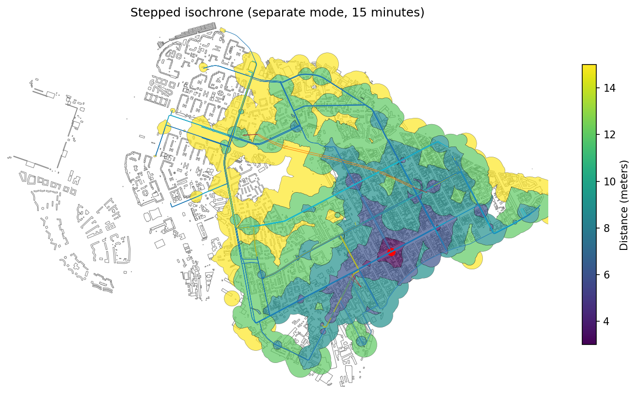
Separate stepped zones visualized per time interval.